When does snow (& ice) start on Friday and how much will Raleigh get? Latest NC forecast
READ MORE
Winter storm in the Triangle
From the forecast and power outages to closings, road conditions and sporting events, here’s everything you need to know about the winter storm in the Triangle.
Expand All
Barring any last minute meteorological curve balls, Raleigh’s snow drought ends today.
Forecasters say a winter storm will arrive in central North Carolina beginning the afternoon of Friday, Jan. 10, dropping snow and ice across the area, before leaving on Saturday.
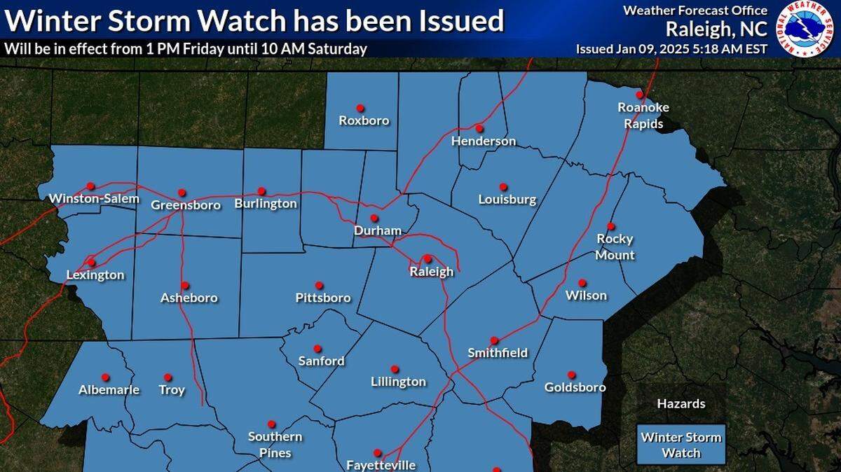
A winter storm warning was issued Thursday afternoon, in effect from 1 p.m. Friday to 10 a.m. Saturday.
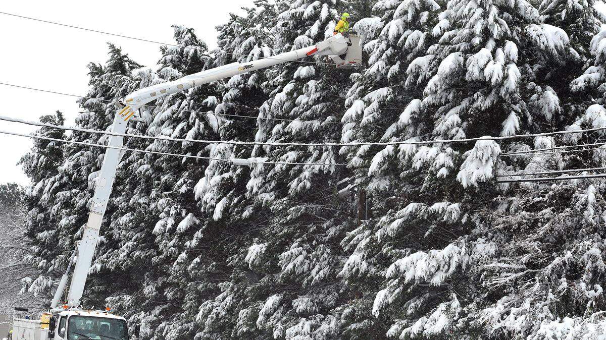
The National Weather Service said Friday morning there is concern this will be more of an “ice storm” than previously expected. Ice accumulation can weigh down power lines, causing them to fall, or cause tree limbs to fall onto the lines.
Precipitation is expected to end in by 6 a.m. Saturday in the Greensboro area, by 7 a.m. in the Triangle and by 8 a.m. in the Coastal Plain and temperatures should be above freezing across the region by 11 a.m. Saturday. However, forecasters say winds will increase to between 20 mph and 30 mph by late Saturday morning and, depending on snow or ice accumulations, could increase the risk of power outages. Gusts up to 35 mph could occur from the Piedmont to the northern Coastal Plain.
Gov. Josh Stein declared a State of Emergency on Thursday, which activates storm response resources and could provide federal reimbursement if necessary. 98 of North Carolina’s 100 counties are expected to get some kind of winter precipitation on Friday.
Here’s the latest.
When will snow and ice start in Raleigh and central NC?
Light snow is expected to start falling between 3 p.m. and 7 p.m. in central NC Friday, from southwest to northeast.
The wintry precip should start falling in Raleigh and the Triangle after 5 p.m. Friday, the Weather Service said in a report Friday morning. Total possible daytime snow accumulation is less than half an inch.
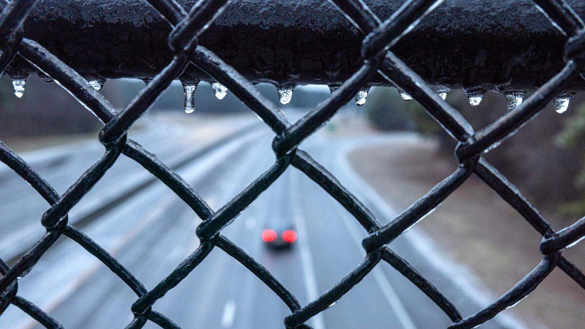
Friday night, freezing rain possibly mixed with snow and sleet will occur, becoming all freezing rain after 1 a.m. The low will be around 28 degrees.
New ice accumulation of one-tenth to two-tenths of an inch is possible.

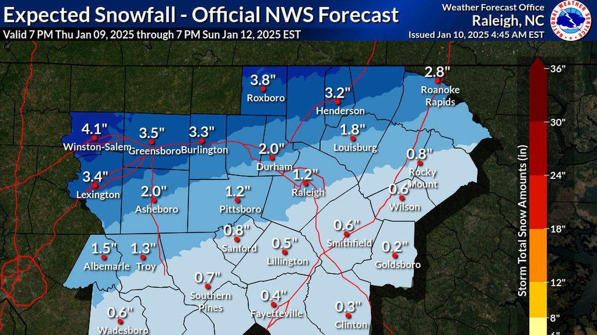
How much snow and ice will we get?
The latest forecast shows the area could get total snow and sleet accumulations of up to 4 inches with ice accumulations up to a quarter-inch, depending on the storm track and how it interacts with the cold air already in place over the state.
Highest snow accumulations are expected north of the I-85 corridor and along the Virginia border, according to the Weather Service.

How much ice does it take to knock out power?
According to Duke Energy, the largest electrical utility in North Carolina, ice buildup of a quarter-inch or more on tree branches can cause them to fall on power lines, leading to outages.
Ice accumulations of a half-inch or more can cause the lines themselves to sag or fall, taking electrical service out. The same can happen with 6 inches or more of wet snow, Duke says.
National Weather Service warns that “numerous power outages” are possible.
What will road conditions be like on Friday?
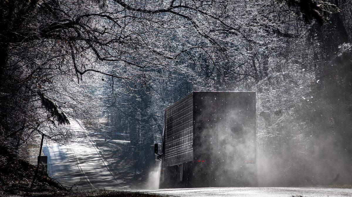
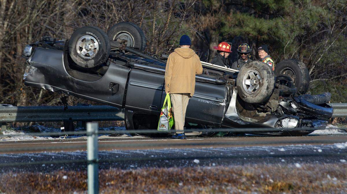
Roads — especially bridges and overpasses — will likely become slick and hazardous, NWS warns, so plan on slippery road conditions, especially during the Friday evening commute hours.
North Carolina Department of Transportation brined major roads ahead of the storm on Thursday and will be positioned to plow and treat snow and ice on state-maintained roads on Friday, according to a release from the Governor’s Office.
The Weather Service said Thursday night that because of cold ground temperatures, snow and ice are likely to stick and accumulate quickly. Untreated roads will be slick.
State transportation officials have urged people not to travel during the storm unless it’s absolutely necessary. Low nighttime temperatures will refreeze anything wet on roads, bridges and overpasses.
“Travel could be treacherous across much of the state through the weekend,” said state Transportation Secretary Joey Hopkins. “We encourage non-essential travel to be limited to allow crews time to safely clear roads.”
This story will update throughout the day on Friday.
This story was originally published January 10, 2025 at 7:00 AM with the headline "When does snow (& ice) start on Friday and how much will Raleigh get? Latest NC forecast."